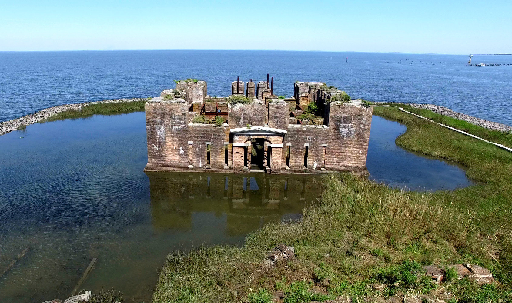
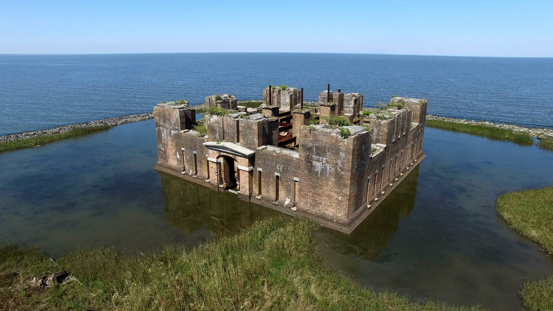
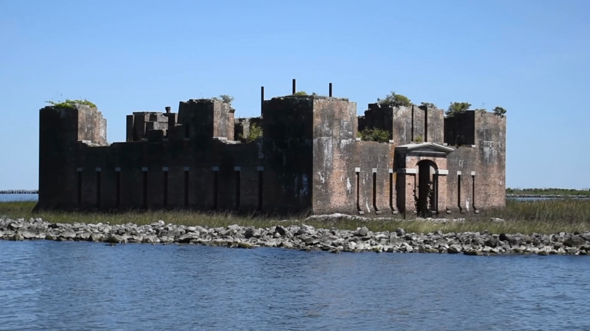
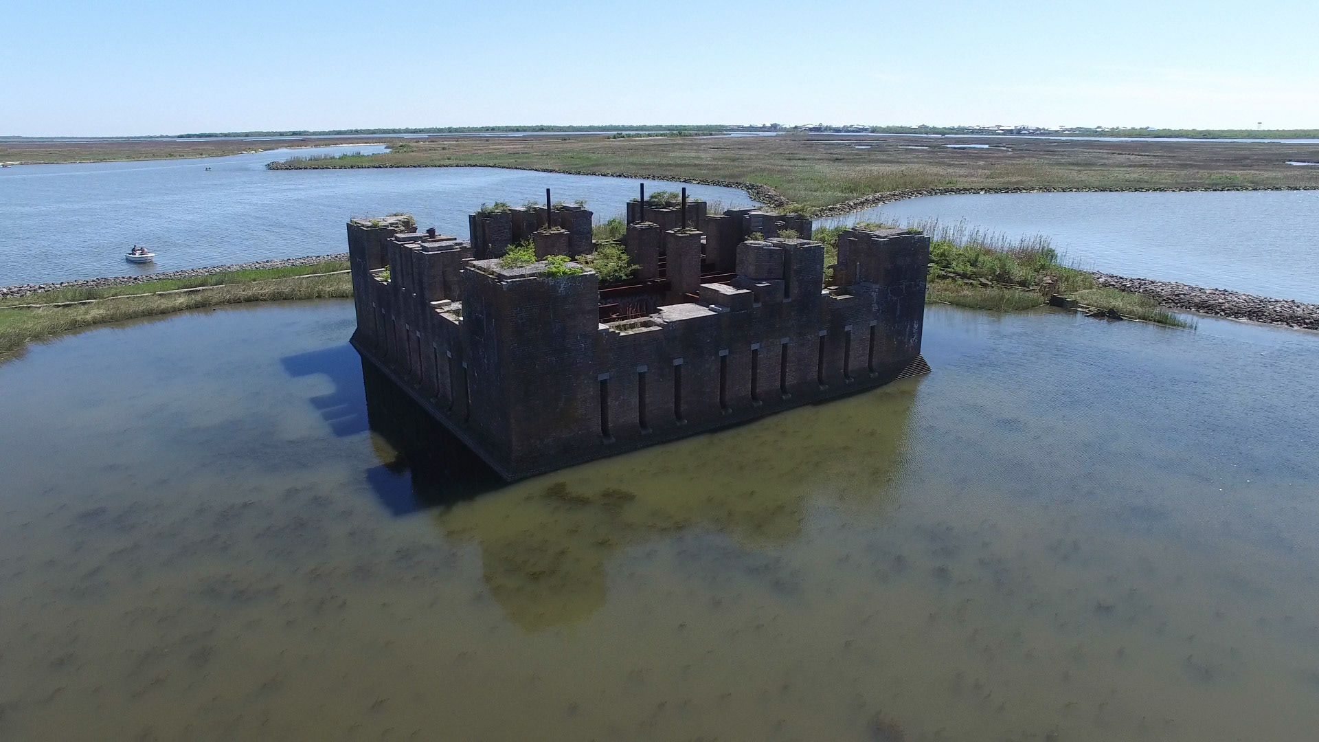
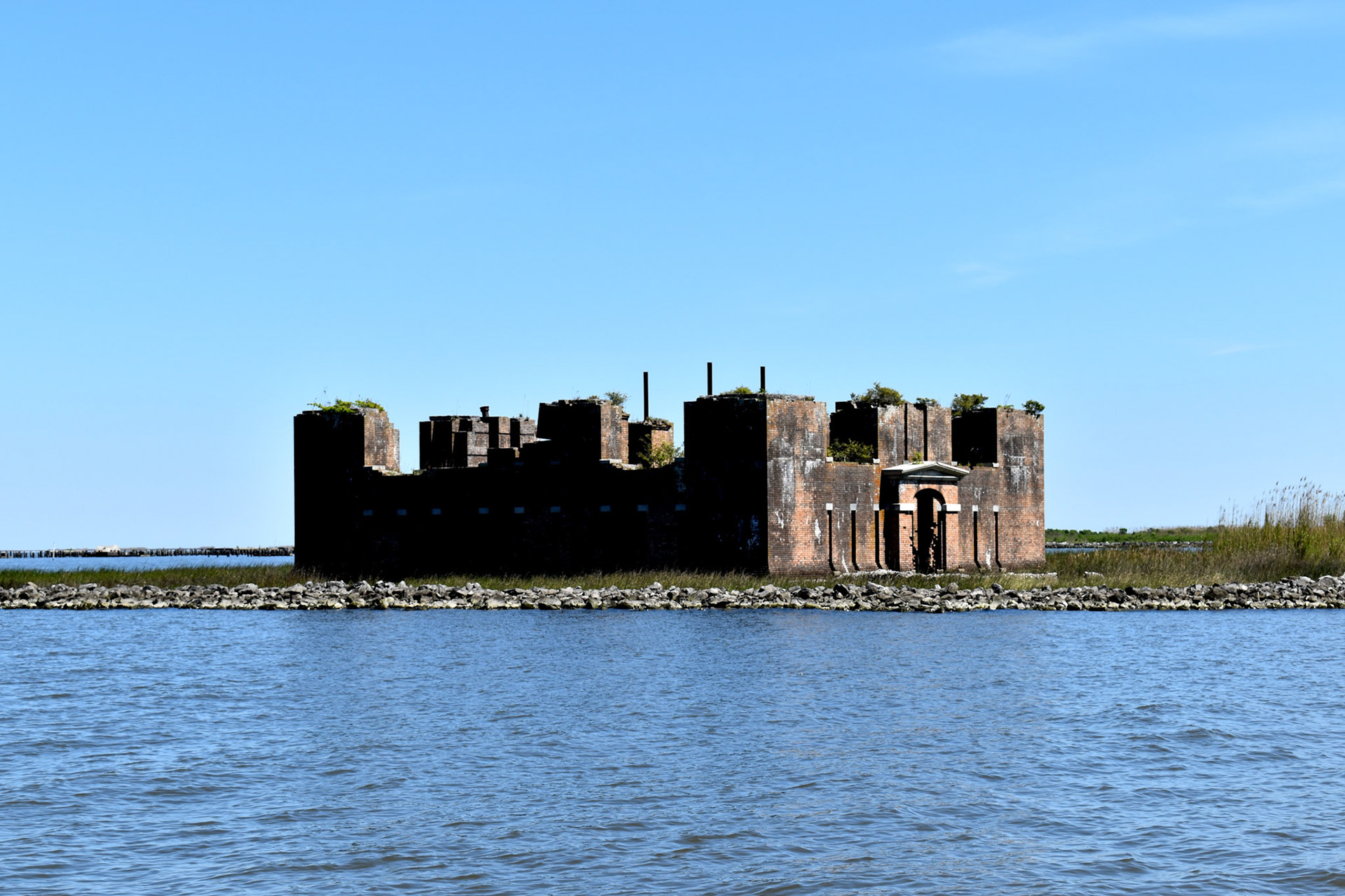
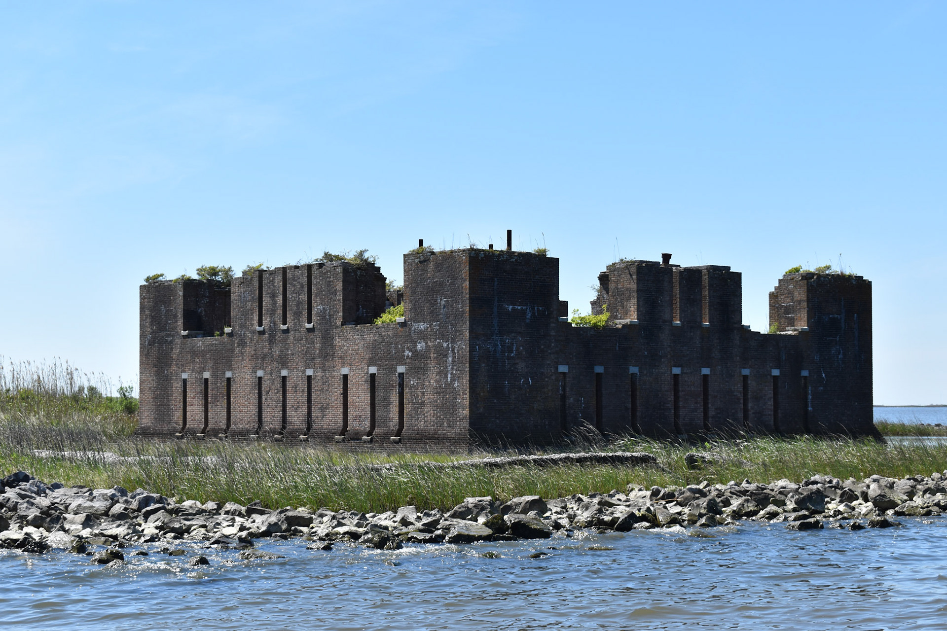
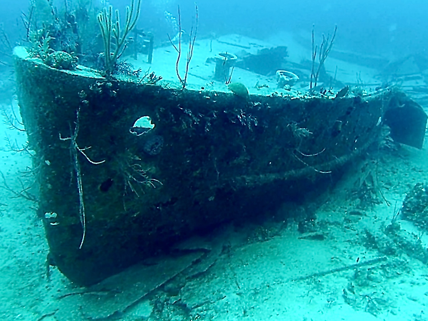
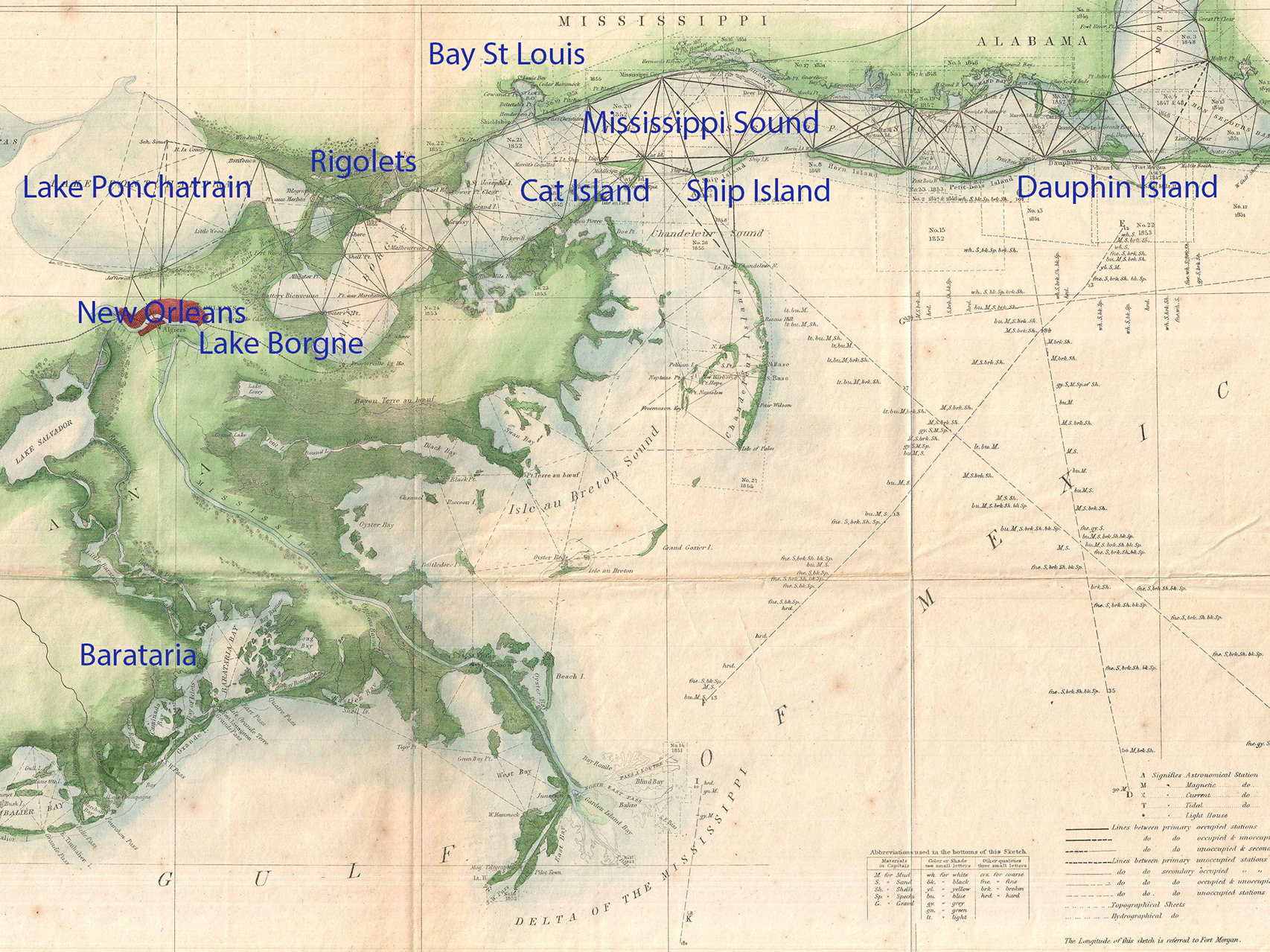
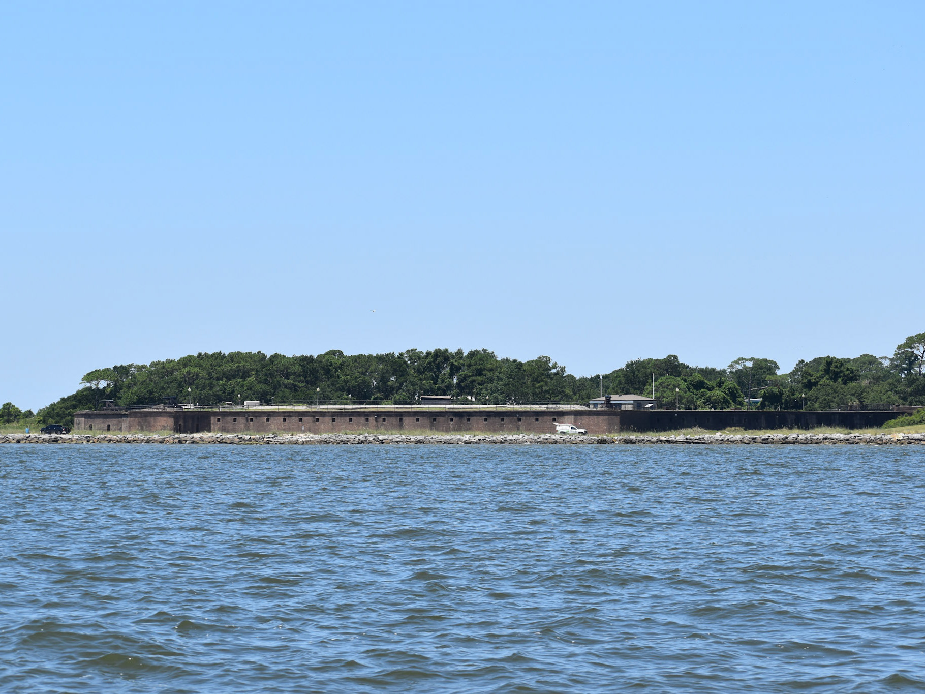
Fort Proctor, a ruined 19th-century coastal fortification located in St. Bernard Parish, Louisiana. Otherwise known as Fort Beauregard or Beauregard's Castle after P.G.T. Beauregard, who supervised its construction. The fortification is located on the southwestern shore of Lake Borgne just north of the entrance to Bayou Yscloskey near the modern-day village of Shell Beach. When the fort was constructed, it was adjacent to a railroad shipping port called Proctors' Landing or "Proctorville." The Proctorville settlement later became known as Shell Beach.
Intended to be part of the defensive fortifications protecting water access to New Orleans, following the British Naval incursion into New Orleans in 1814.
Due to delays and damage caused by recurrent hurricanes in the Gulf region, and the subsequent outbreak of the Civil War, the fortification never saw active service. Following the end of the Civil War, improvements in coastal gunnery and artillery rendered the fort obsolete.
Land access to the fortification was cut off following the construction of the Mississippi River-Gulf Outlet Canal in the 1960s
The fort was unusual in its design for two innovations: the inclusion of comfortable living quarters including bathrooms, and the extensive use of structural iron in its construction. The fort is now entirely surrounded by shallow water.
It is believed to be the inspiration for the current "castle" design found on the US Army Corps of Engineers banner.
Raw Overflight Footage can be Viewed at: https://www.youtube.com/watch?v=cqgWKMKp7sE